Land Management
We provide a variety of land management services, such as:

Prescribed burns – Fire is an excellent tool for forestry and wildlife management.
We perform prescribed burns on natural timber as well as pine plantations. We are a Certified Prescribed Burn Manager and will carefully plan and implement your fire plan.

- Make food plots for numerous game species such as deer and turkey, as well as strips and plots for quail.
- Manage timber in relation to wildlife needs and requirements.
- Choose the correct seasonal food sources to increase wildlife populations.
- Use controlled burns to promote brooding and nesting, to increase needed cover, and increase important food sources.

We provide:
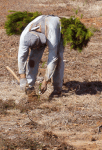
- Clearing and raking for reforestation after timber is cut.
- Clearing permanent fire lanes around property for fire protection.
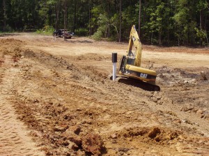
- Building fish ponds, duck ponds and wildlife food plots.
- We also provide forestry mulching.
We have all the equipment needed for most any project.

Boundary painting – We periodically paint our clients property lines with high quality boundary paint. This helps our clients as well as their neighbors know where the property lines are.
Mapping – Our team uses ArcMap, the latest and most cutting edge mapping software on the market today. We use this technology to prepare timber sales, calculate acreages, determine topography, and to meet many other needs. ArcMap is a very accurate and cost efficient method of mapping and determining acres of timber stands and tracts for many different cases.
Drone Inspections – We also provide our landowners with updated drone inspections of their property. These aerials are useful in the marketing of land sales, as well as pine beetle inspections, timber cutting updates, and 

